Sponsored
Guest Post Watch:
Protect your paid backlinks Automatically. Track, monitor, and enforce backlinks you pay for or exchange.
Products
Submit Product
Videos
Blog
Advertise
Gis
Explore all products tagged with Gis
Submit Your Product
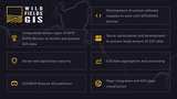
Wild Fields GIS
Integration of GPS and GNSS devices and development for GIS software.
View
GIS
gnss
Software development
3 years ago
3 years ago
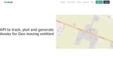
GeoHook
An API to track, plot and generate webhooks for Geo moving entities
View
API
automation
GIS
4 years ago
4 years ago
Spatialnode
The professional community for the GIS people.
View
community
GIS
Talent Platform
4 years ago
4 years ago
Attentive AI
Fast track your satellite/drone/aerial imagery into digital maps through AI
View
artificial intelligence
digital maps
GIS
6 years ago
6 years ago
Elebase
Elebase is a back end as a service with geospatial capabilities.
View
Backend as a service
GIS
headless cms
6 years ago
6 years ago
Mapzania
Advanced client and server geospatial and mapping functionality in your .NET solutions.
View
DOT NET Software Development
geospatial
GIS
Mapping
Nuget
webapp
8 years ago
8 years ago
MapTiler Cloud
Online maps and hosting for your products
View
GIS
Google maps
Javascript SDK
maps
online maps
Open data
open source
OpenStreetMap
8 years ago
8 years ago
truMaps
truMaps, the next generation of paper maps.
View
AR
augmented
education
Geographic Information System
GIS
map
Virtual
VR
9 years ago
Featured
9 years ago
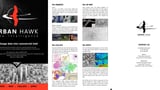
Urban Hawk
Geospatial Data Intelligence consultancy transforming into highly scalable market enabler.
View
future cities
geospatial
GIS
local government
logistics
smart cities
surveillance
transport
9 years ago
9 years ago
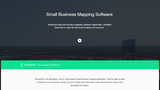
Geniusgis
Small Business Mapping Software
View
3D mapping
GIS
Google maps
9 years ago
9 years ago
Next Page
Sponsors
Show Your Product Here
Gain maximum exposure for your brand with a high-impact ad space here for a full month
Reddit Growth for SaaS
Reddit marketing built to drive demos, trials, and SaaS signups.