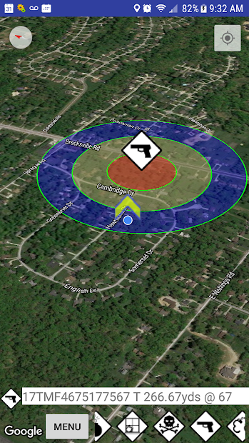
Position Sharing & Situational Awareness GEOINT application, developed in partnership with emergency responders and risk managers. Uses: . Locate other team members and targets of interest in realtime with phone GPS . Violent intruder / Shooter . Search and Rescue (SAR) . Airborne/fire prediction . Emergency Response Plans . Fire / earthquake / flood / severe weather . Radiological event / chemical spill . Other natural and man-made disaster response plans . Evacuation / escape routes . Road blocks, triage and family reunification locations . Staging areas for community and volunteers, fireman, police, SWAT teams, emergency managers, and local stakeholders, risk management, rescue . Public safety 911, EMS, Fire, Law Enforcement and Public Health teams Secure realtime server
