
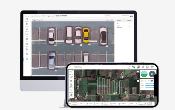
PicStork is the perfect solution for professionals requiring aerial image analytics. Its comprehensive workflow helps to simplify the entire process from capturing images to processing data, enabling users to train detectors and analyze data independently. By utilizing PicStork, they can save precious time by automating tedious processes and streamlining their workflow. With automated pipelines, users can gather insights from their aerial imagery quickly for analysis purposes. In addition, its intuitive user interface simplifies the data processing process and offers a variety of opportunities for monitoring changes in landscapes over time. By utilizing PicStork’s advanced machine-learning capabilities, it’s possible to gain even more insights from your collected imagery with little effort. From crop management to infrastructure projects, stay informed about any development with the help of PicStork. With powerful end-to-end automation backed by top-notch accuracy PicStork stands out as an ideal choice for professionals seeking premier image analytics solutions.
SponsoredGuest Post Watch:
Protect your paid backlinks Automatically. Track, monitor, and enforce backlinks you pay for or exchange.