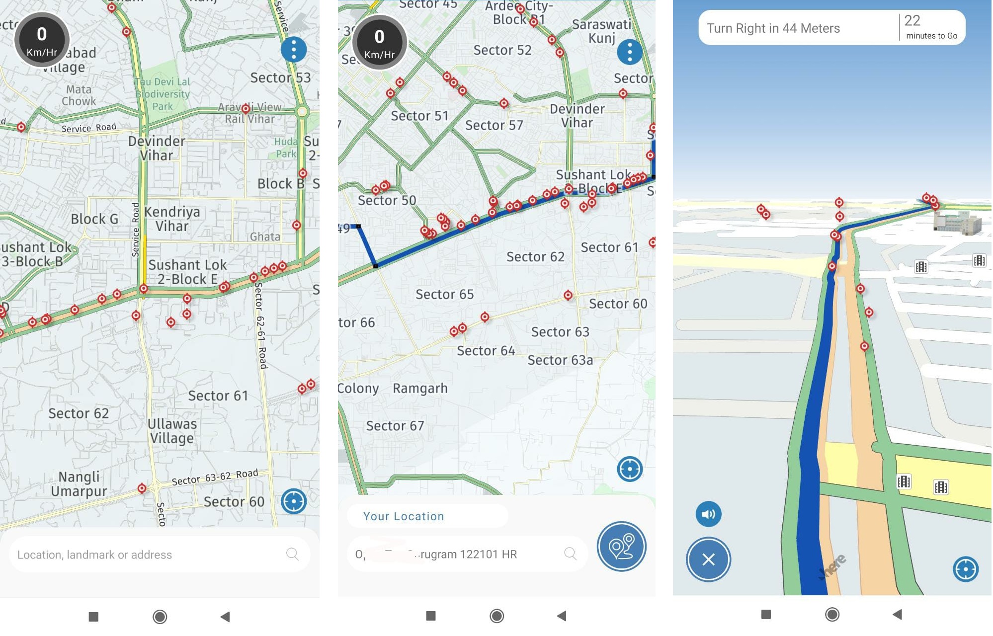
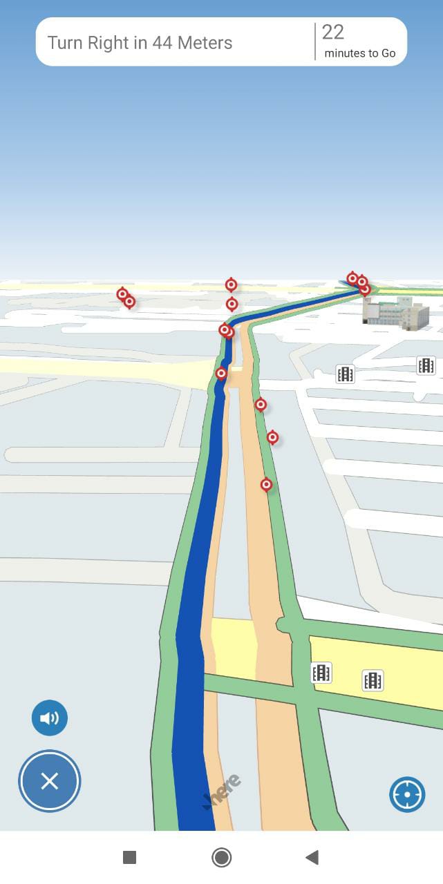
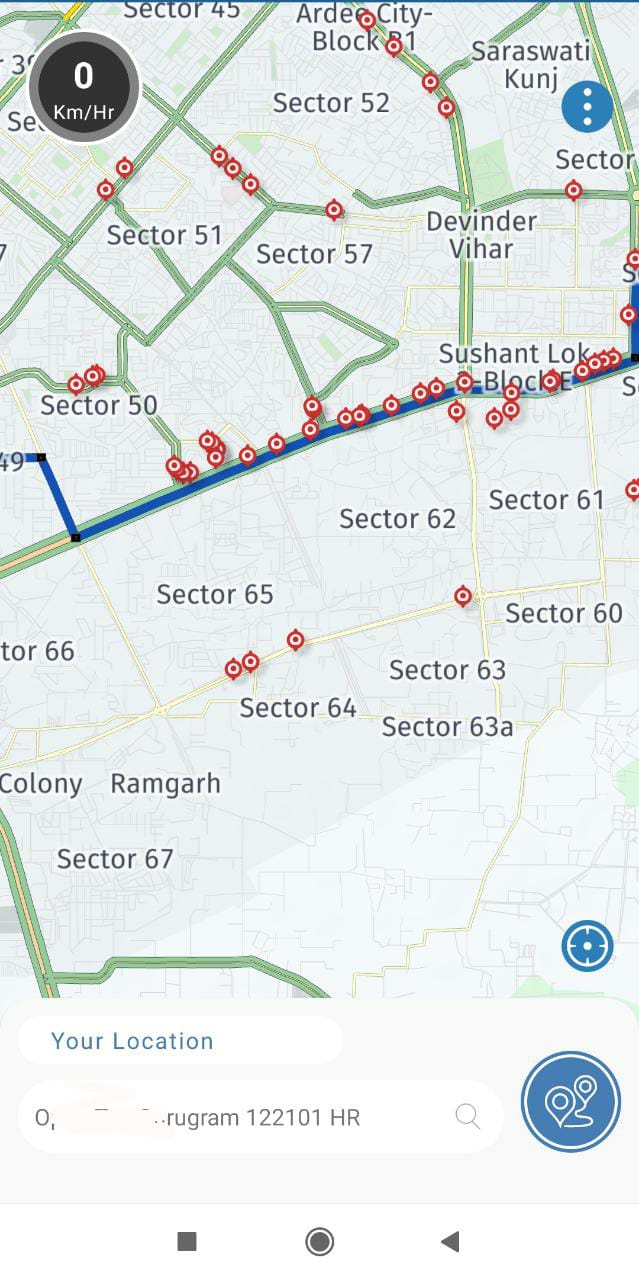
In India, an average of 400 people lose their lives on a daily basis in road accidents. WIth a large fraction of road users being motorcyclists, just potholes and poorly designed speed breakers alone account for around 5 percent of these numbers. Almost every year during the monsoon rains, news is full of reports of accidents and road casualties caused by terrible road conditions made worse by the rains. As a team, we are trying to do something about it and Intents Go is just one of the steps in that direction. Intents Go offers voice guided navigation along with alerts for potholes and bad patches of roads. Apart from that, there are also alerts for incidents on the road like waterlogging, blockages and more. The data about road conditions and incidents is updated in real time. Currently we are using maps by Here Technologies. The images show my neighbourhood and the red dots you see on the map are identified potholes and broken patches. The data is gathered via a community of scouts and our proprietary tech that uses phone sensors to map the roads. The scouts majorly include cab drivers, truckers, delivery agents and other people who are often on the road and they are rewarded regularly for the distances they cover. So far, thanks to our 200,000 strong community of Scouts, this is where we stand: Total Distance Mapped - 2,000,000 kms (2 million kms / ~1.24 million miles) Distance mapped daily - 150,000 kms (150K kms / ~93K miles) Potholes / Speed Bumps identified - Over 185,000 New potholes / speed bumps identified daily - Around 9,000 Potholes / road patches recorded repaired daily - Around 4,500 We have tried to avoid collecting any bit of data that can be personally identifiable and since Go doesn’t require any user account, it is lot more private than the more popular options. We introduced this beta last night and would really appreciate feedback, questions and suggestions on this. If you would like to chat in detail, I am available at akshay@intents.mobi.
Intents Go
Privacy focussed maps for India with pothole alerts. 185,000 potholes mapped and counting