

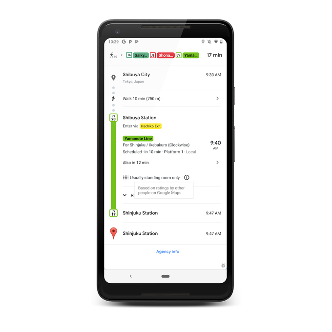
On days when everything runs smoothly, taking public transit is one of the best ways to get around town. Not only is it cost-effective and efficient, but it also lets you stay hands free so you can sit back, relax and maybe even read a few chapters of your favorite book. But unexpected delays or overcrowded vehicles can quickly turn your ride from enjoyable to stressful. Starting today, Google Maps is rolling out two new features to help you better plan for your transit ride and stay more comfortable along the way. -Live traffic delays for buses You’ll now be able to see if your bus will be late, how long the delay will be, and more accurate travel times based on live traffic conditions along your route. You’ll also see exactly where the delays are on the map so you know what to expect before you even hop on your bus. -Crowdedness predictions There’s nothing more uncomfortable than being packed like a can of sardines on a hot, sweaty train. We’re introducing transit crowdedness predictions so you can see how crowded your bus, train or subway is likely to be based on past rides. Now you can make an informed decision about whether or not you want to squeeze on, or wait a few more minutes for a vehicle where you’re more likely to snag a seat.
Published At